Solar Carports vs Rooftop Solar: Which One Should Your Business Choose?
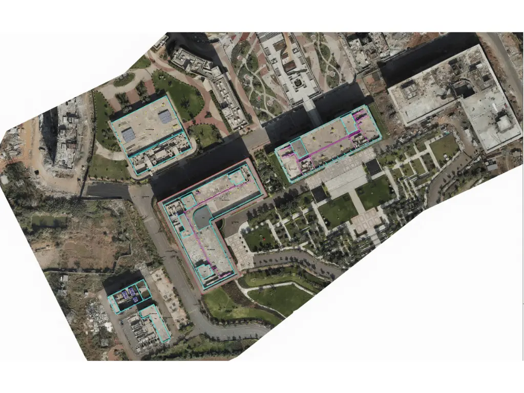
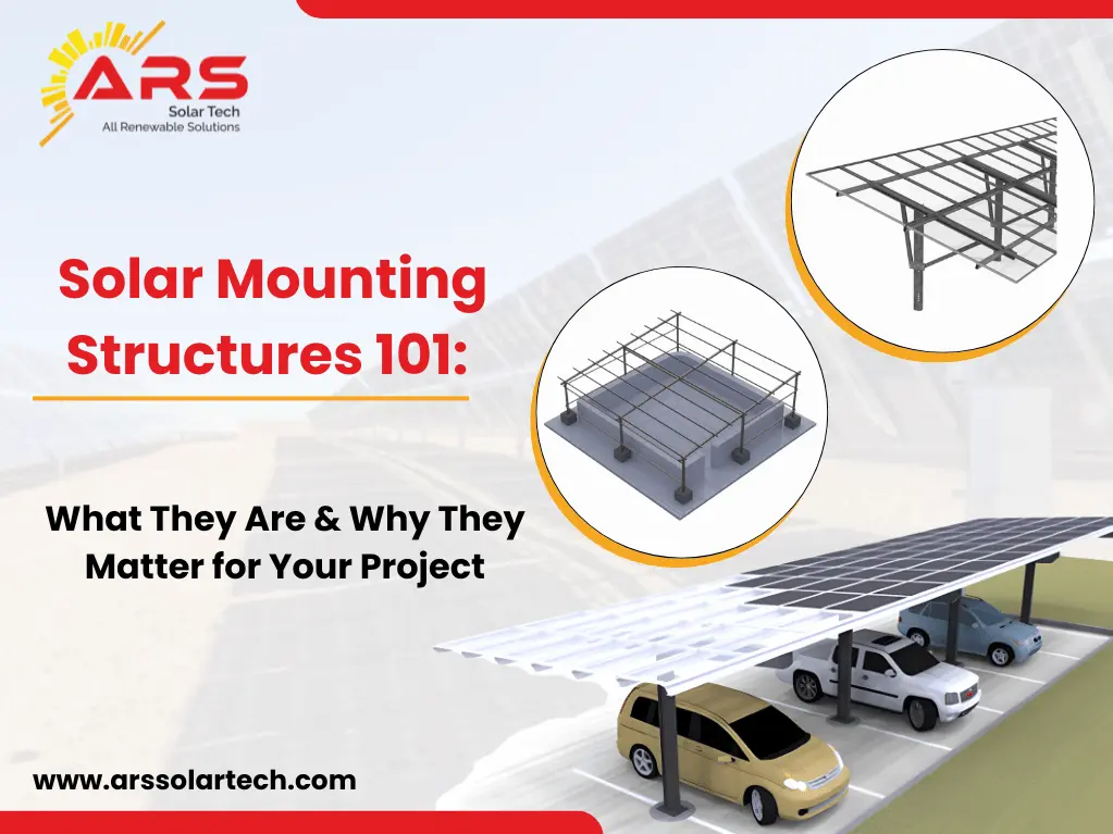
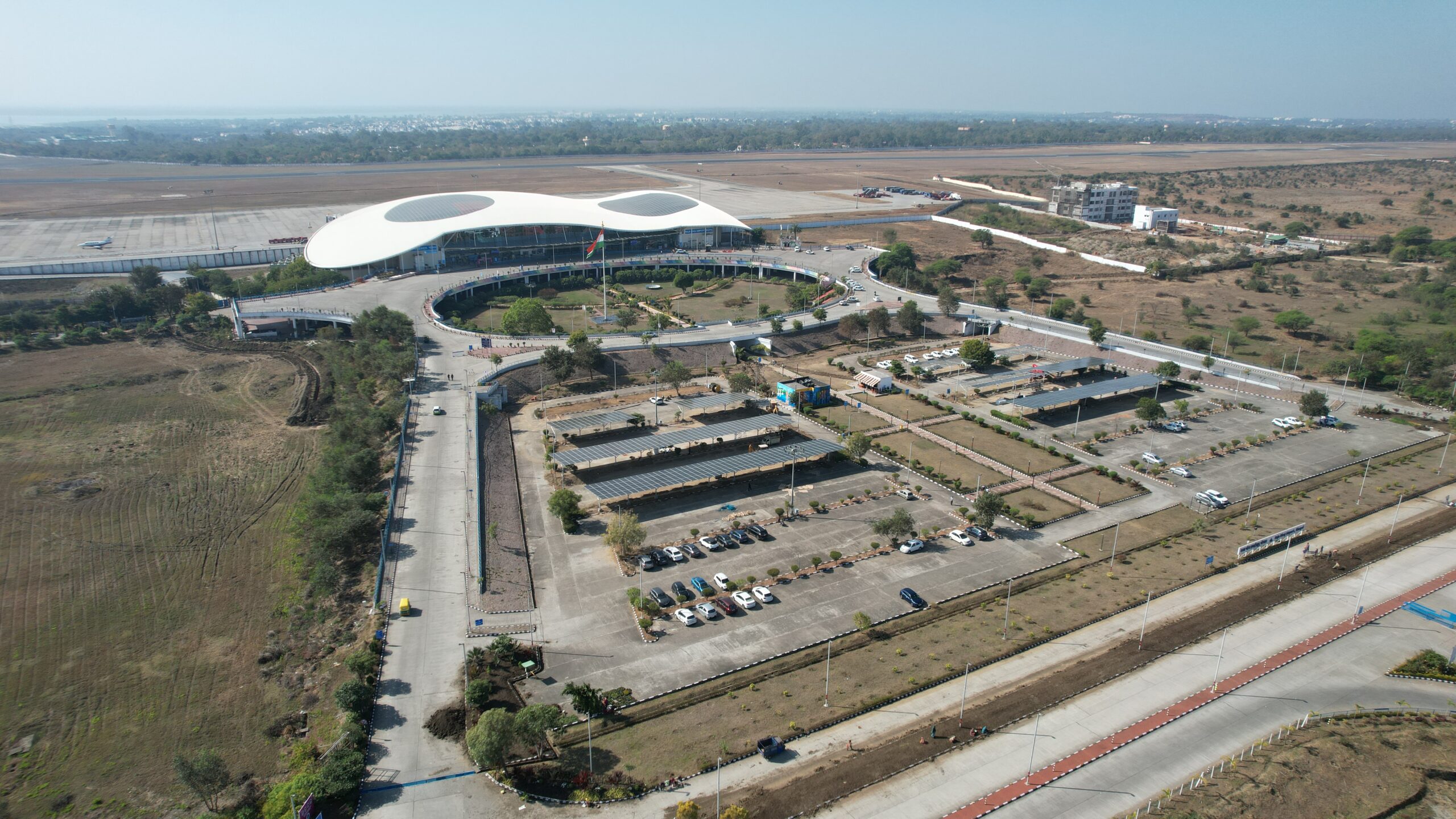
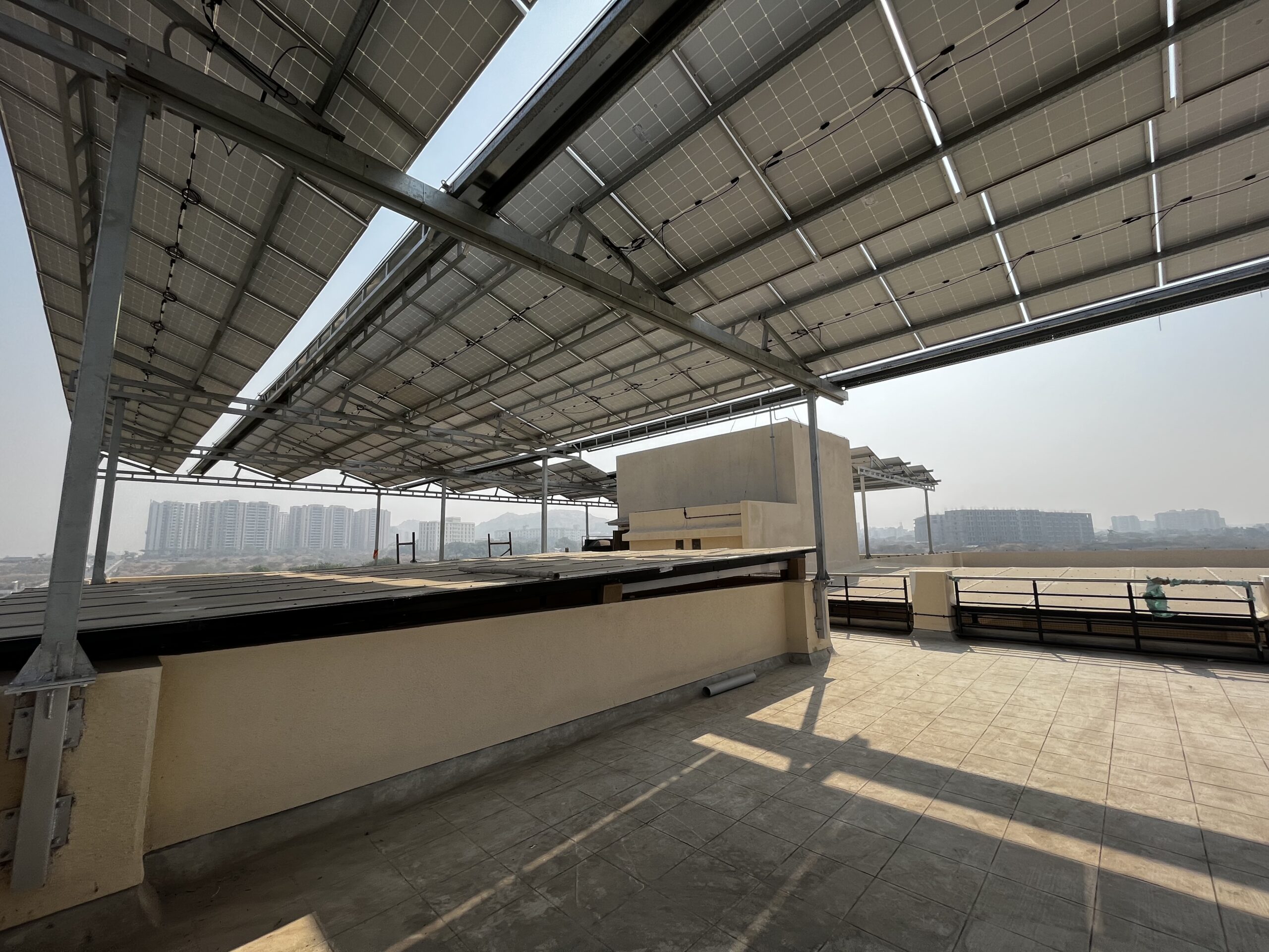
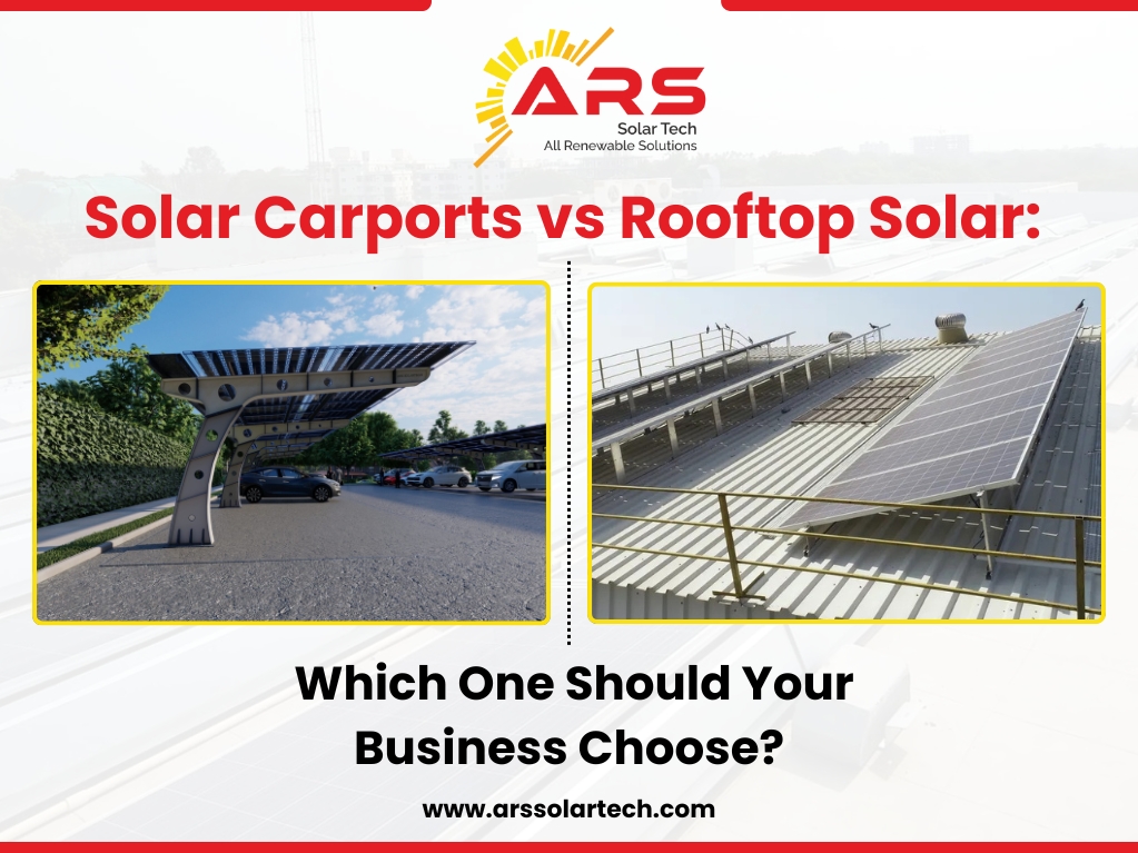
As India accelerates toward a cleaner and more sustainable energy future, businesses are exploring smart solar power solutions to cut energy costs, reduce carbon emissions, and build resilience against rising electricity tariffs. Two of the most popular options for commercial and industrial solar installations are solar carports and rooftop solar systems. While both solutions harness abundant sunlight to generate clean power, each comes with its own set of advantages and practical considerations. What Are Solar Carports and Rooftop Solar Systems? Rooftop Solar refers to photovoltaic (PV) panels installed directly on the existing roof of a building — whether commercial warehouses, office spaces, or factories. These systems leverage unused rooftop space to generate electricity. Solar Carports are elevated canopy-like structures installed primarily over parking areas. The PV panels form the roof of the carport, producing power while simultaneously providing shade and shelter for vehicles. Space Utilization: Maximizing Every Inch Rooftop Solar takes advantage of otherwise idle roof space. For businesses with expansive, unobstructed rooftops, solar panels can cover large surface areas to generate significant amounts of power. These systems are ideal when rooftop access is available, structurally sound, and compatible with solar orientation. However, not all rooftops are suitable. Structures with complex geometry, shading from nearby buildings or trees, and roofs nearing the end of their service life may hinder efficient solar installation. By contrast, Solar Carports transform under-utilized parking areas into productive energy spaces. Instead of leaving parking lots bare, installing solar carports allows businesses to harvest solar energy without compromising usable roof space. This becomes especially useful in commercial complexes, manufacturing facilities, and retail properties with limited rooftop area. Energy Output and Efficiency: Which Performs Better? When it comes to pure energy generation, several factors come into play — panel orientation, shading, temperature, and available surface area. Rooftop Solar Systems Pros: Often close to the building’s energy infrastructure, reducing transmission losses. Cons: Roof obstructions like HVAC equipment, water tanks, or skylights can limit panel placement, sometimes reducing overall yield. Solar Carports Pros: Typically installed at optimized tilt angles with minimal shading, which can enhance energy production. With open space, carports often allow better airflow, reducing panel temperature and improving performance. Cons: Distance from the main building may require additional cabling and electrical work. In many industrial and commercial settings, solar carports can match or even outperform rooftop solar in overall generation capacity — especially when rooftop space is limited or heavily shaded. Structural & Installation Considerations Rooftop Solar Installing solar on a roof requires thorough structural assessment. The building must support the weight of panels, mounting structures, and withstand wind loads. Roof condition is a key factor — if the roof needs repair or replacement soon, it’s often more cost-effective to address that before or alongside solar installation. Solar Carports Carports require standalone foundations. While this increases initial installation complexity, it eliminates concerns about roof load capacity. As long as the parking surface and ground conditions are suitable, solar carports can be installed without disruption to building infrastructure. Cost Comparison: What’s the Investment Like? Upfront Costs Rooftop Solar generally has lower installation costs since it uses existing structure without needing additional ground construction. Solar Carports require more materials and foundational work, leading to higher initial costs. Long-Term Savings Though solar carports may cost more upfront, they often deliver greater energy yield and multifunctional benefits (shaded parking), improving overall return on investment (ROI). The right choice depends on your business’s unique context, budget, and long-term strategic goals. Choosing the Right Solution for Your Business So, how do you decide between solar carport vs rooftop solar for your commercial or industrial solar installation? Here’s a quick decision guide: Choose Rooftop Solar If: Your rooftop area is large, unobstructed, and structurally sound. You want a cost-effective solution with minimal ground construction. Roof access is easy and meets safety requirements. Choose Solar Carports If: Your rooftop space is inadequate or shaded. You have large parking areas that aren’t generating value. You want added utility like shaded parking and brand visibility. Increased energy output and modular expansion are priorities. Commercial Solar with ARS Solar Tech At ARS Solar Tech, we specialise in commercial solar solutions and industrial solar installations that deliver optimum performance and long-term value. Whether you’re exploring solar carports, rooftop solar systems, or hybrid installations that combine both, our expert team guides you through every step — from site assessment and design to installation and post-commissioning support. With rising energy costs and sustainability goals becoming non-negotiable for modern businesses, the right solar strategy is one that aligns with your operational needs, budget, and environmental commitment. Conclusion Both solar carports and rooftop solar systems are excellent investments for businesses ready to embrace renewable energy. The decision ultimately comes down to space availability, energy needs, strategic goals, and long-term planning. Make the smart choice — evaluate your site, analyse your energy profile, and partner with trusted solar experts like ARS Solar Tech to transition smoothly toward cleaner, greener energy.