How ARS SolarTech Delivers Precision in Every Solar Project
A successful solar project begins with accurate site data. Before designing or installing a solar system, it is essential to understand the roof structure, load capacity, shading, and real site conditions. At ARS SolarTech, we lead the industry with advanced site survey techniques and drone-based solar surveys that ensure each solar installation is engineered with precision.
Why Site Surveys Matter in Solar Projects
Accurate Roof Assessment
Every roof is different. A detailed drone-based solar survey helps evaluate:
- Roof size, slope, and material
- Load-bearing capacity
- Structural health and safety
- Usable space for solar installation
This ensures that the mounting structure is safe, durable, and optimized for performance.
Identify Obstacles & Shading
Most residential and commercial rooftops have obstacles like:
- Water tanks
- Parapet walls
- Lift rooms
- Vent pipes
- HVAC units
These elements can cause shading and reduce power generation.
Our site survey identifies their exact location, helping us design the most efficient solar layout.
Better Design & Cable Planning
Using survey data, we plan:
- Optimal panel placement
- Stringing and cable routing
- Inverter location
- Walkways and maintenance access
This minimizes installation errors and ensures long-term reliability.
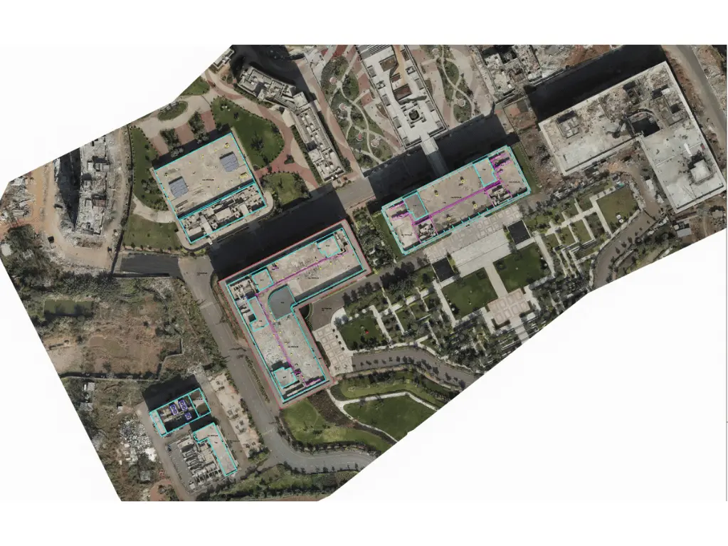
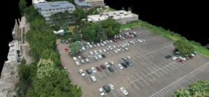
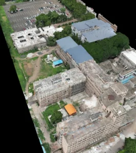
Drone-Based Solar Survey & Mapping – A Game Changer for Design
Traditional manual surveys can miss important measurements on complex or multi-level roofs. Drone-based solar survey provide accurate, high-resolution data that improves design precision and reduces project risk.
At ARS Solartech, drone mapping is integrated into our standard design workflow.
Benefits of Drone-Based Solar Surveying
High-Precision 2D & 3D Mapping
Drone captures help us obtain:
- Exact rooftop dimensions
- Irregular roof shapes
- Boundary edges
- Height differences and contours
This allows for highly accurate solar design and structural planning.
Accurate Obstacle Dimensions & Shading Analysis
Drone-generated 3D models help determine:
- Height of obstacles
- Distance and spacing
- Shading impact throughout the day
This improves system output and prevents installation conflicts on-site.
Faster, Safer & More Reliable
Drone surveys reduce human risk and deliver results quickly—ideal for tall buildings, weak roofs, or congested areas.
Superior Structure Design Accuracy
Drone data enables our engineers to create:
- Detailed roof models
- Digital elevation maps
- High-accuracy design drawings
Resulting in better load distribution, stronger structures, and easier installation.
ARS Solartech — Pioneering Advanced Survey & Solar Structure Engineering
As a leader in solar structure design, ARS Solartech uses modern tools like drone surveying, 3D mapping, and engineering-grade analysis to deliver:
- More accurate designs
- Higher energy generation
- Lower shading losses
- Faster project execution
- Safer on-site operations
- Reduced installation rework
Our commitment to innovation ensures every project meets the highest technical standards.
Conclusion: Precision Surveys = Better Solar Projects
Whether it’s a residential building with complex roofs or a large commercial facility, accurate surveying and drone mapping ensure a smarter and more efficient solar installation.
By combining deep engineering expertise with advanced surveying technology, ARS Solartech delivers reliable and optimized solar solutions for every site.